
Features Karkulka
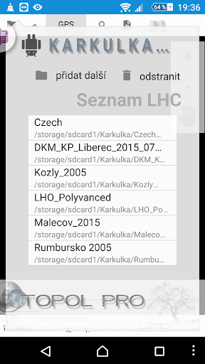
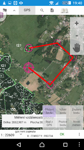
Hood is the ideal mobile assistant to the woods for anyone who wants to use the map and data outputs created under the Ministry of Health information standard for forestry.It allows you to view various types of maps thematically tailored to the end user, a random map the vegetation, contour mining or specifically combined types containing more thematic layers as typology or parcel information.Orientation in space and simplifies positioning and map using GPS satellites.All data, including graphical and geographical are stored locally on the device and is not dependent on an Internet connection.It provides a tool for finding and selecting units of spatial division of the forest at different levels and to selected parts of the forest connects adequate information from the numerical part of the plan in the form of a sheet of books.It is equipped with simple editing through which the user can automatically capture Track, staked line drawings of either full or manually with the help of GPS, providing maps, or add notes cartographic points.Použitý coordinate system for viewing geographic bases is S-JTSK.Hood is simply a companion with whom you do not lose the forest.
Social Features
Connect and share with friends and the community.
Fitness Tracking
Track your workouts and monitor your health metrics.
Travel Features
Plan and manage your travels with ease.
See the Karkulka in Action

Get the App Today
Available for Android 8.0 and above